Captain_Oblivious
DIS Dad #257, Galactic Salad Dodger
- Joined
- Nov 10, 2008
Chapter 5: An Ice Age Here, A Million Years of Mountain Building There…Geology is the Study of Pressure and Time.
I was determined to beat the I-25 traffic this time, so Julie and I were up and getting ready by 5:30 a.m. Thankfully, the kids were also still somewhat on East Coast time and got up early, and we actually managed to have breakfast and be on the road by 6:45 a.m. This is a minor miracle with four kids.
But it paid off. Traffic on I-25 was actually moving. Even better, it was moving at the speed limit! I almost stopped to buy lottery tickets right then and there.
We got past downtown Denver and headed north. Traffic was already starting to back up in the southbound direction, so we were thankful to be heading away. We figured we’d have a nice, easy drive for an hour or so with the majestic Rocky Mountains keeping us company to the west.
Then the fog rolled in. So long, Rocky Mountains. Traffic slowed for a bit due to the poor visibility. Still, it was better than heading southbound. The only driver I saw who didn’t have any trouble with the fog was, of course, Batman.
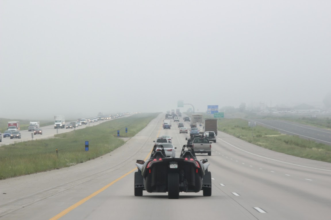
The driver was wearing a suit and tie, so I guess technically it was Bruce Wayne.
We could have driven through Boulder along the edge of the mountain range, but Jill had warned us that Boulder was another traffic nightmare in the morning, so we took the interstate instead. We got off at the Loveland exit, Rt. 34 west. Coincidentally, so did Batman. We caught up to him at a stop light.
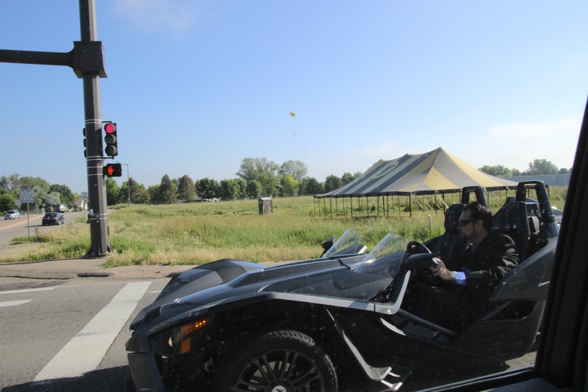
I tried to make eye contact. Being Batman, he did not acknowledge my existence. Why so serious? I revved the engine. And yes, when the light turned green, I floored it. My Toyota Sienna blew the Batmobile’s doors off.
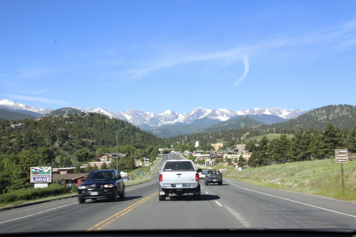
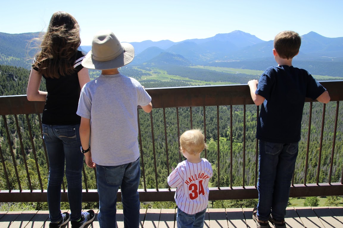
Rt. 34 is a beautiful drive. A portion of it meanders along a river through Big Thompson Canyon, providing gorgeous mountain scenery all around as you drive. Eventually, you emerge into the town of Estes Park and are greeted with this:
This is the eastern gateway to Rocky Mountain National Park.
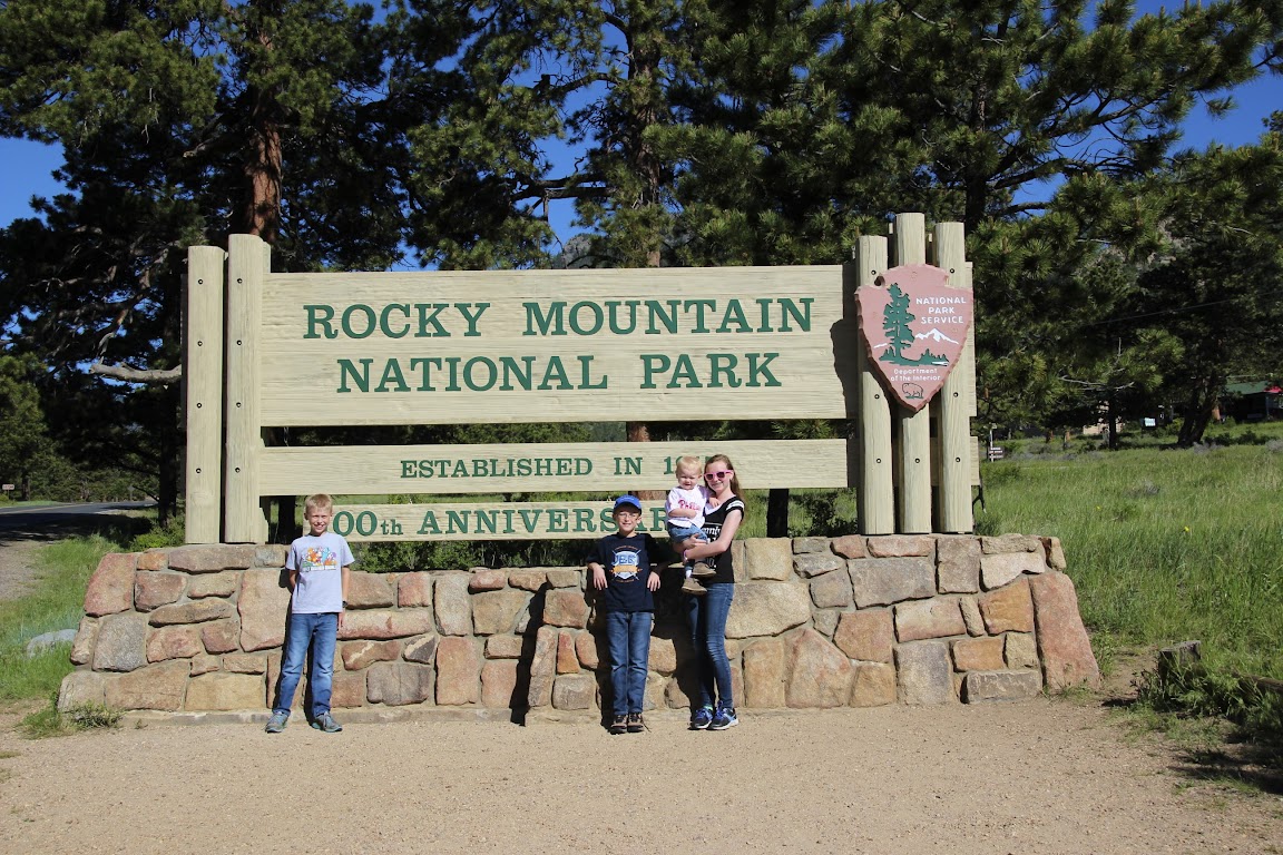
Rocky Mountain N.P. was celebrating its 100th anniversary in 2015, and as a result, they had scheduled dozens of special “celebration events”. Looking through the calendar, it appeared to me that “celebration events” = “lectures”. So, um, we skipped them. Anyway, the park has been around for 100 years.
Our aim for the day was to get our coveted National Park passport stamp, get the kids their coveted Junior Ranger badges, and drive the length of Trail Ridge Road. This road, the original “highway to the sky”, was first opened in 1932 and travels 48 miles from Estes Park to Grand Lake at the western border of the park. In the middle, it climbs the Rocky Mountains. This includes several miles above the tree line at 11,500 feet to a high point of 12,183 feet. It’s no problem as long as there is no one in your party suffering from altitude sickness.
We stopped at the main visitor center at Beaver Meadows to take care of the first two items on our list. For those who are unfamiliar, just about every National Park offers a Junior Ranger program for kids. They are given a workbook with a number of activities to do depending upon their age, and typically one of those activities is to watch a video in the visitor center or attend a ranger program. When they have completed the requisite number of activities, they can return the book to a ranger who will check their work, swear them in as an honorary park ranger and award them a plastic ranger badge with the park’s name on it. The upshot is that it’s a good way to maintain the kids’ interest while you drive from overlook to overlook within the park.
At the ranger gate, we bought another National Park Annual Pass. I'd done the math, and for $80 it would once again turn out to save us money compared to paying the entrance fee at each park we planned to visit.
The President had announced earlier in the year that the U.S. would be offering a program this year that gave every 4th-grade child in America a free annual pass, in order to encourage kids to visit these national treasures. Great idea! Unfortunately, we found out later that the passes would only be good during the school year and not, say, during the summer when people with kids actually travel. So we had to fork out the $80.
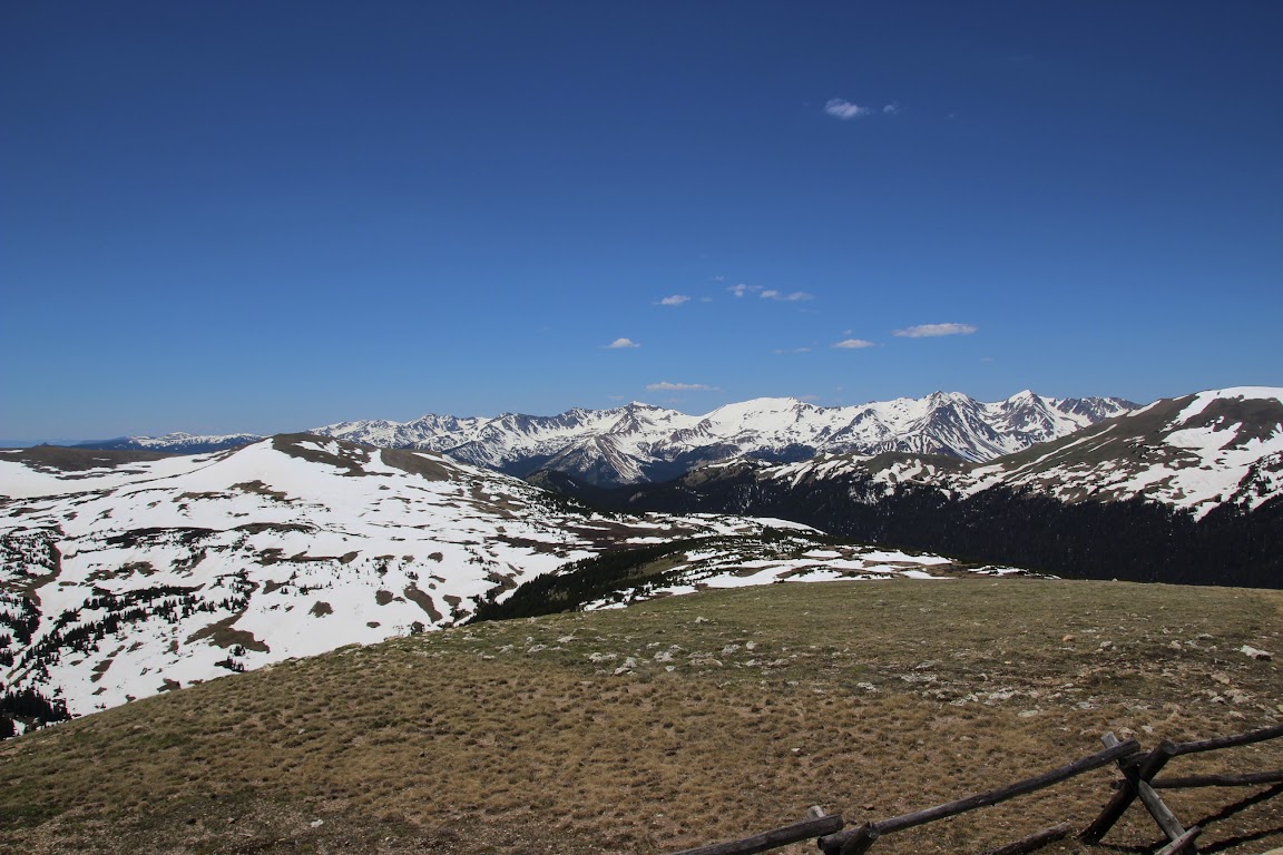
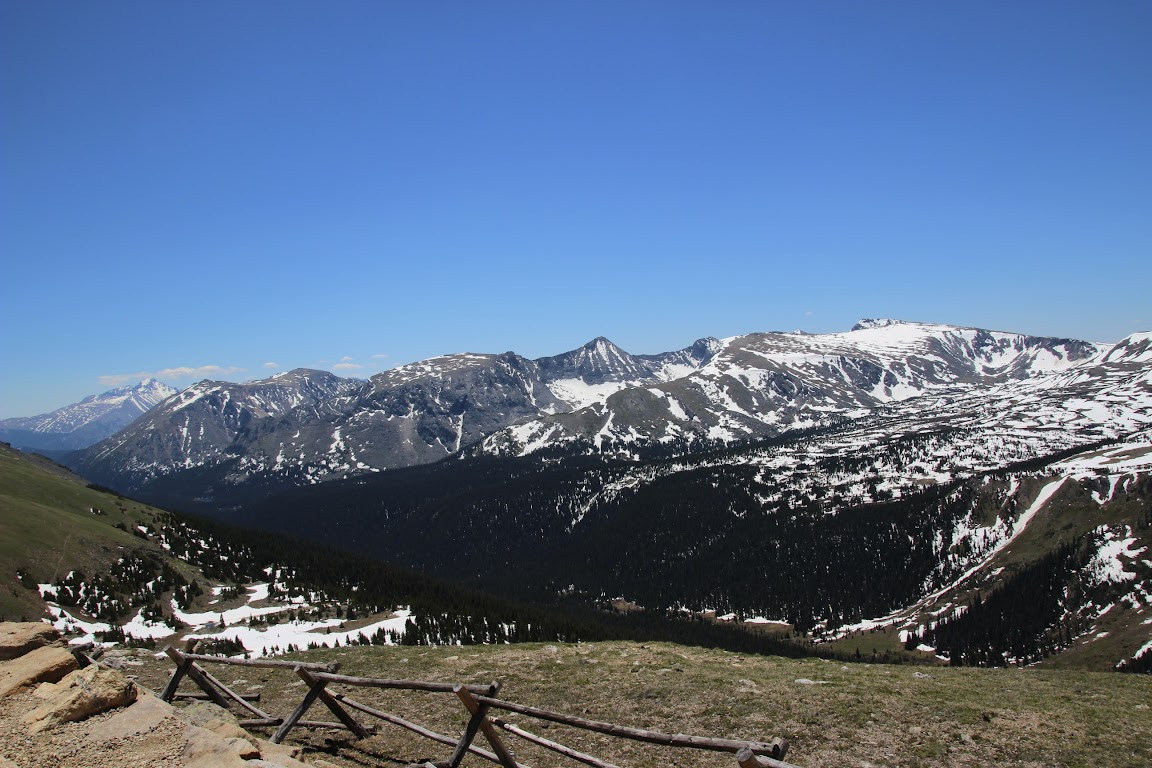
We set out on our drive, and for the next few hours we were simply spellbound. It was a gorgeous, bright, clear day, and the views were simply unparalleled.
Many Parks Curve:
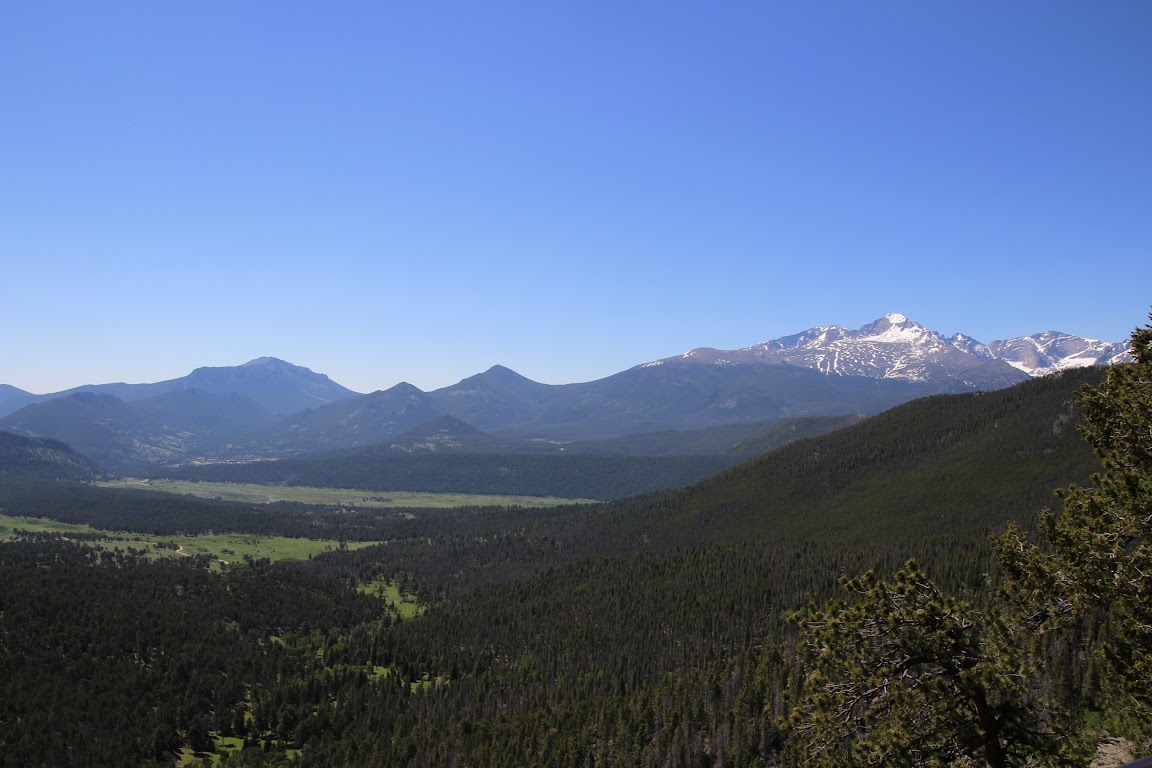
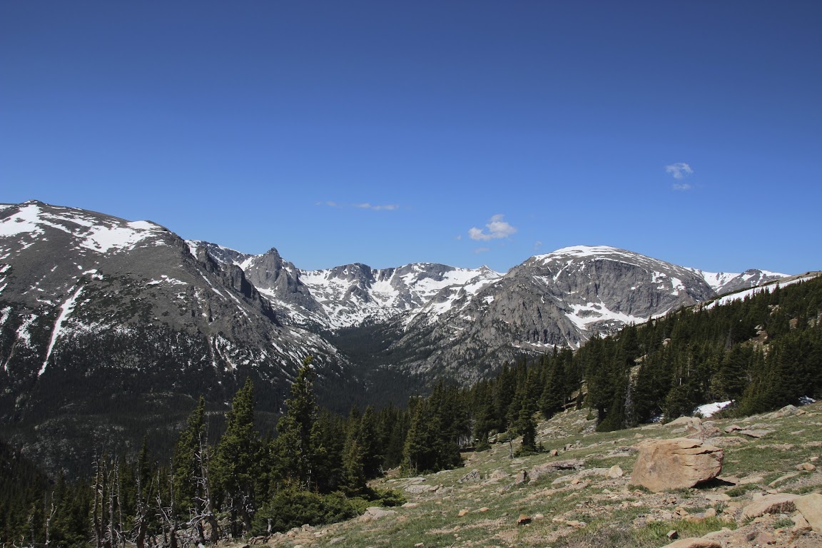
This is Long’s Peak, the highest point in the park:
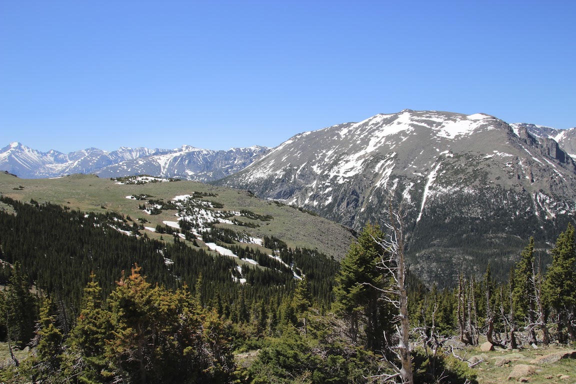
Eventually, we drove up past the tree line and into the [NFL Films Voice] Frozen Tundra of Rocky Mountain National Park [/NFL Films Voice]. In the clear, cool air, we could see for miles.
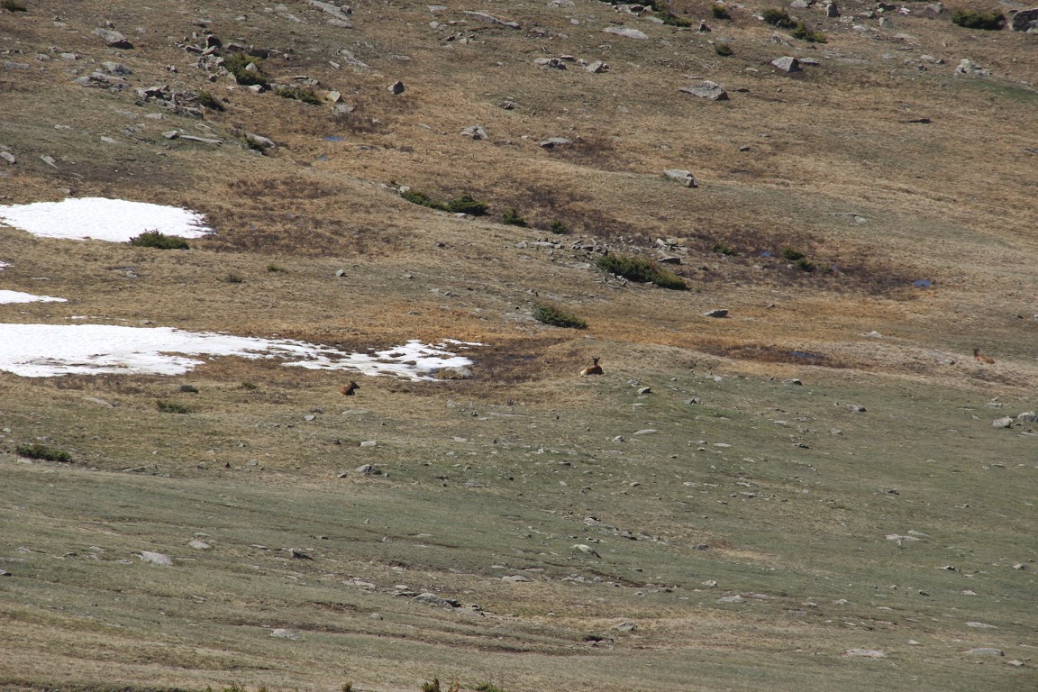
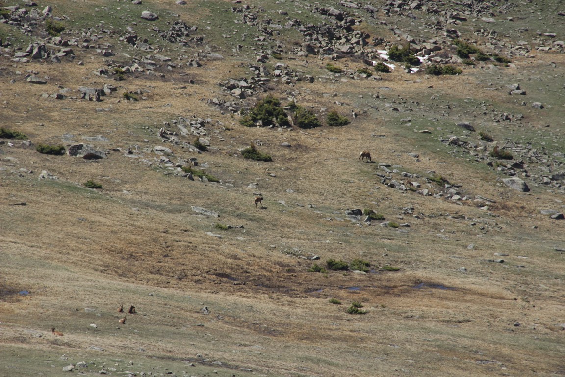
We approached a long, sweeping curve. There were a few cars pulled over to the side and people walking down the mountain slopes.
Pro Tip: in National Parks, if you suddenly see several cars parked on the shoulder, the chances are very good that you’re about to see some wildlife. And some idiots trying to get too close to wild animals so they can take selfies with them. Wanna know how I got these scars?
We looked beyond the people walking down the slopes and, lo and behold, saw our first wildlife of the vacation. A herd of elk was lazily grazing nearby.
Not much further along, we stopped at a trailhead. Having learned absolutely no lessons from our experience with thin mountain air on Pikes Peak the day before, we had decided to take an uphill hike together. For added fun, I’d be carrying 30 lbs. of baby in a backpack.
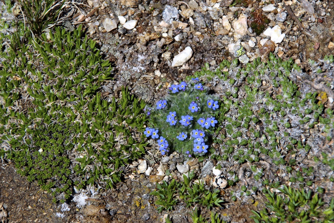
We took the Tundra Communities trail, which is a little less than a mile long and allows you to see some of the tundra plant life as well as mountain views all around. Along the way, you reach about 12,000 feet in elevation. The start of the hike is fairly steep uphill, and in thin air, that’s hard work. It didn’t take long before I was breathing heavily and forcing myself to drink water and slow down.
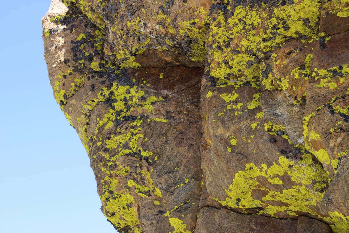
But it’s not without its rewards. After all, you get to see lichen, a sort of algae/moss growth on the rocks.
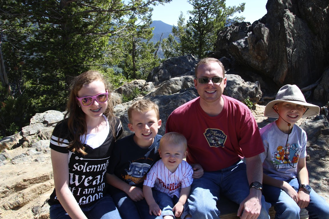
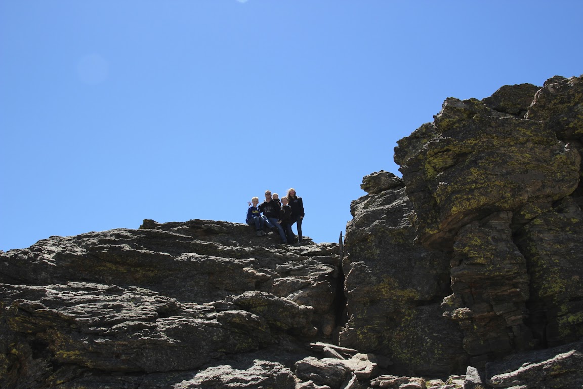
Not impressed? Fine. Let’s just enjoy the views, then. And some family photos.
Future Facebook profile photo:
Yikes! Let’s try that one again.
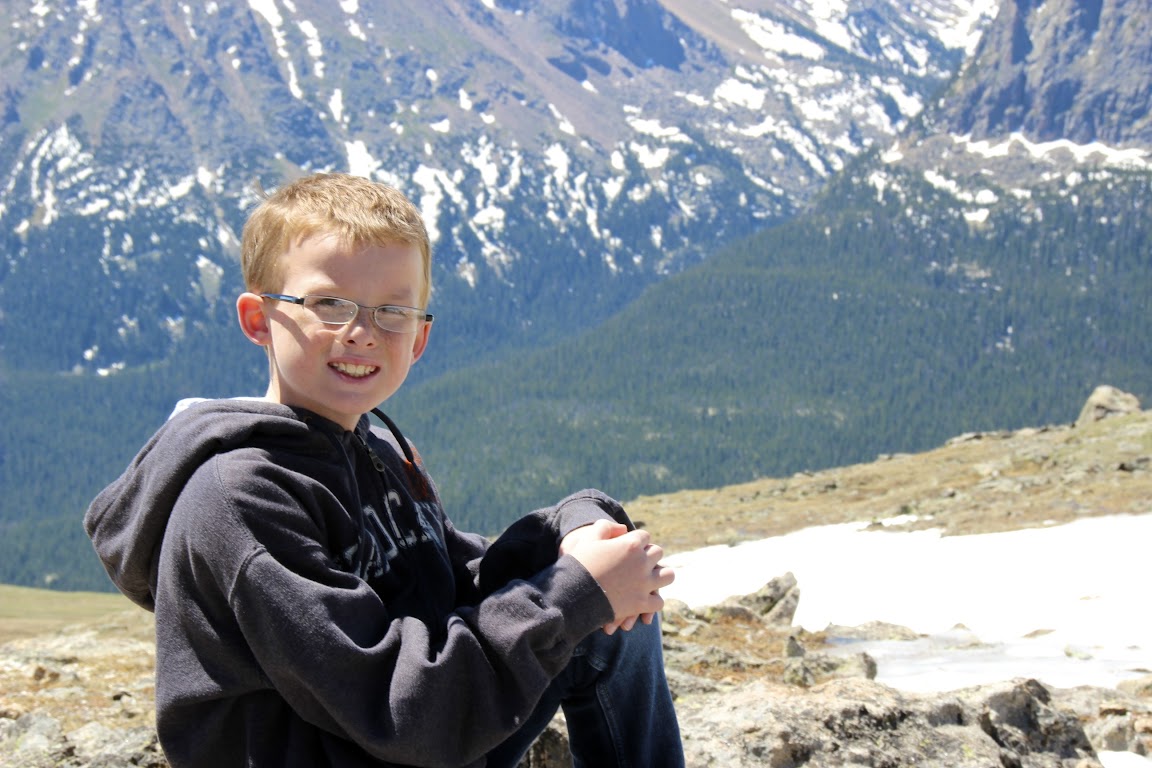
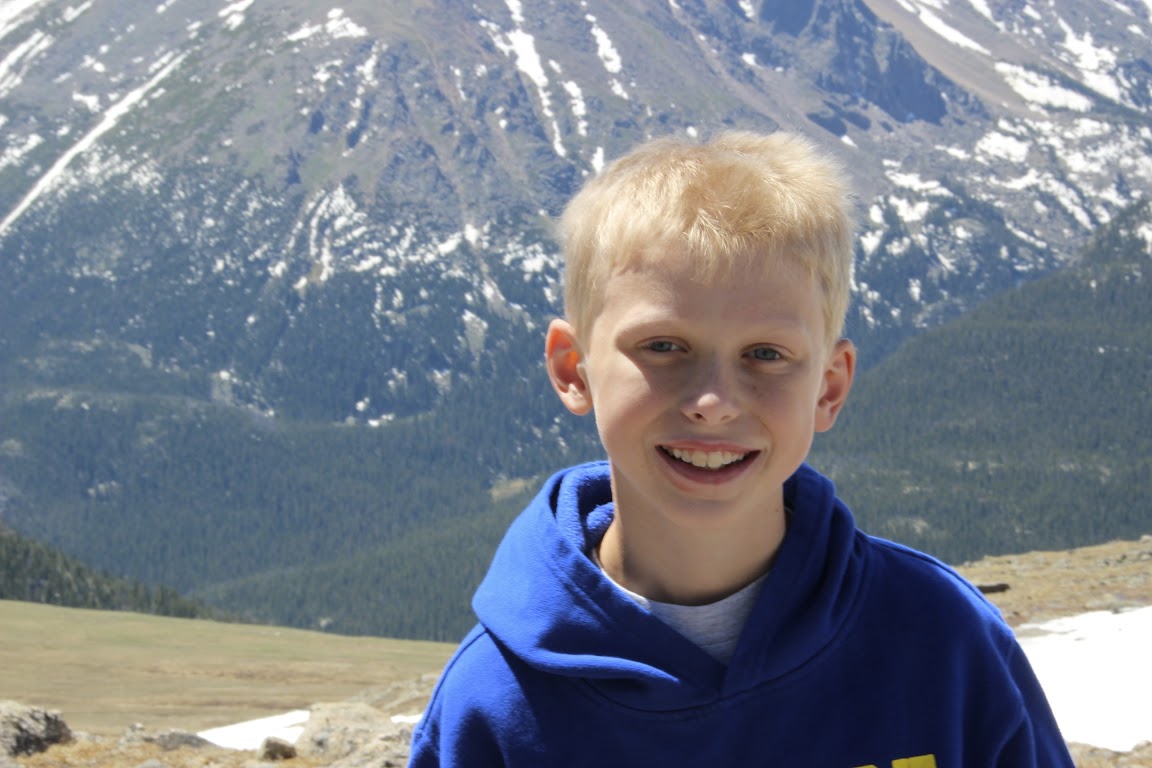
Me and my boyz:
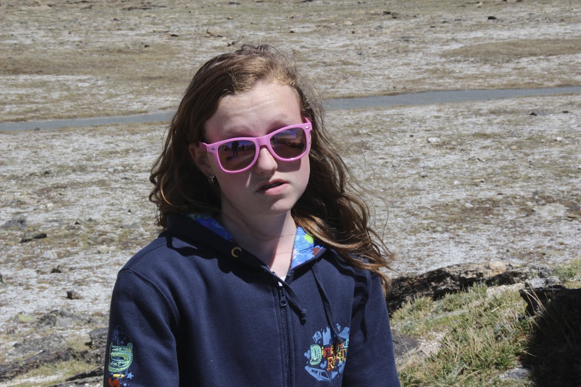
My girlz:
I have to admit, I ran out of ways to describe how glorious the views were up here.
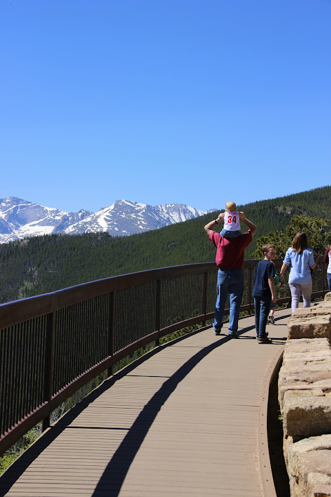
Our lunch stop was the Alpine Visitor Center, which holds the honor of being the National Park building located at the highest elevation of any (approx. 10,500 ft.). It’s only open when Trail Ridge Road is fully open, which is typically from late May to mid-October, depending on how quickly they can clear the snow. So if you’re ever planning a trip here, you only get a limited window to drive the length of Trail Ridge Road. And you won't be able to do that if you're depending on the government's free annual pass program. But I'm not bitter about that.
There’s another hiking trail here, but it basically climbs straight up a mountain slope for a half mile before reaching a viewpoint. We’d had enough of mountain climbing for the day, so we settled for PB&J sandwiches and a tour around the gift shop. And Holy Cheetos, of course.
Throughout our trips, the kids have started various collections (besides junior ranger badges). Sarah collects vintage/retro postcards, David collects patches, and Scotty collects pins. Normally here I'd start to mention the hits my wallet was beginning to take, but they'd earned enough lawn-mowing, snow-shoveling, and babysitting money to be able to start paying for this stuff themselves.
In other words, the hits to my wallet had happened much earlier in the year.
Coming Up Next: More mountains, more wildlife, and Drew takes a shot at cooking up some dinner.
I was determined to beat the I-25 traffic this time, so Julie and I were up and getting ready by 5:30 a.m. Thankfully, the kids were also still somewhat on East Coast time and got up early, and we actually managed to have breakfast and be on the road by 6:45 a.m. This is a minor miracle with four kids.
But it paid off. Traffic on I-25 was actually moving. Even better, it was moving at the speed limit! I almost stopped to buy lottery tickets right then and there.
We got past downtown Denver and headed north. Traffic was already starting to back up in the southbound direction, so we were thankful to be heading away. We figured we’d have a nice, easy drive for an hour or so with the majestic Rocky Mountains keeping us company to the west.
Then the fog rolled in. So long, Rocky Mountains. Traffic slowed for a bit due to the poor visibility. Still, it was better than heading southbound. The only driver I saw who didn’t have any trouble with the fog was, of course, Batman.
The driver was wearing a suit and tie, so I guess technically it was Bruce Wayne.
We could have driven through Boulder along the edge of the mountain range, but Jill had warned us that Boulder was another traffic nightmare in the morning, so we took the interstate instead. We got off at the Loveland exit, Rt. 34 west. Coincidentally, so did Batman. We caught up to him at a stop light.
I tried to make eye contact. Being Batman, he did not acknowledge my existence. Why so serious? I revved the engine. And yes, when the light turned green, I floored it. My Toyota Sienna blew the Batmobile’s doors off.
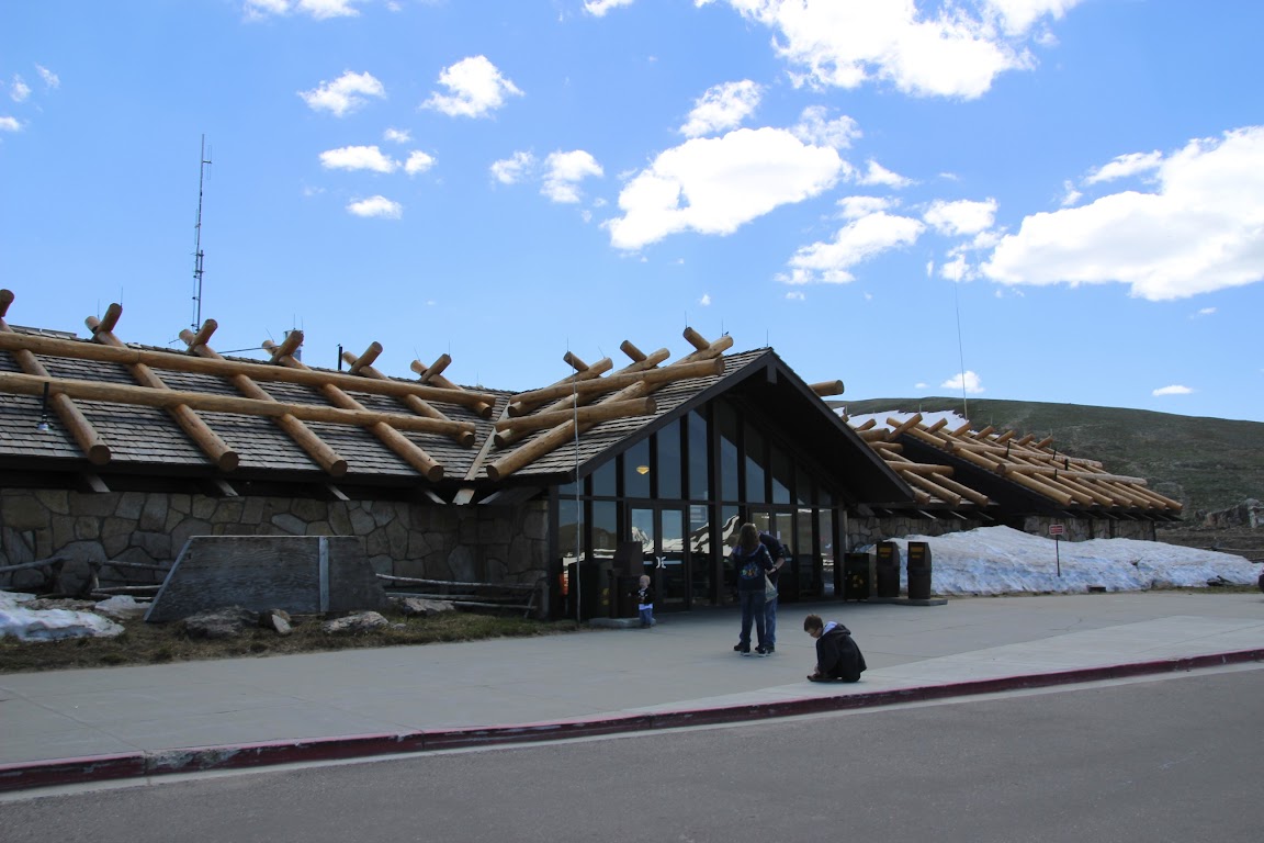
Rt. 34 is a beautiful drive. A portion of it meanders along a river through Big Thompson Canyon, providing gorgeous mountain scenery all around as you drive. Eventually, you emerge into the town of Estes Park and are greeted with this:
This is the eastern gateway to Rocky Mountain National Park.
Rocky Mountain N.P. was celebrating its 100th anniversary in 2015, and as a result, they had scheduled dozens of special “celebration events”. Looking through the calendar, it appeared to me that “celebration events” = “lectures”. So, um, we skipped them. Anyway, the park has been around for 100 years.
Our aim for the day was to get our coveted National Park passport stamp, get the kids their coveted Junior Ranger badges, and drive the length of Trail Ridge Road. This road, the original “highway to the sky”, was first opened in 1932 and travels 48 miles from Estes Park to Grand Lake at the western border of the park. In the middle, it climbs the Rocky Mountains. This includes several miles above the tree line at 11,500 feet to a high point of 12,183 feet. It’s no problem as long as there is no one in your party suffering from altitude sickness.
We stopped at the main visitor center at Beaver Meadows to take care of the first two items on our list. For those who are unfamiliar, just about every National Park offers a Junior Ranger program for kids. They are given a workbook with a number of activities to do depending upon their age, and typically one of those activities is to watch a video in the visitor center or attend a ranger program. When they have completed the requisite number of activities, they can return the book to a ranger who will check their work, swear them in as an honorary park ranger and award them a plastic ranger badge with the park’s name on it. The upshot is that it’s a good way to maintain the kids’ interest while you drive from overlook to overlook within the park.
At the ranger gate, we bought another National Park Annual Pass. I'd done the math, and for $80 it would once again turn out to save us money compared to paying the entrance fee at each park we planned to visit.
The President had announced earlier in the year that the U.S. would be offering a program this year that gave every 4th-grade child in America a free annual pass, in order to encourage kids to visit these national treasures. Great idea! Unfortunately, we found out later that the passes would only be good during the school year and not, say, during the summer when people with kids actually travel. So we had to fork out the $80.
We set out on our drive, and for the next few hours we were simply spellbound. It was a gorgeous, bright, clear day, and the views were simply unparalleled.
Many Parks Curve:
This is Long’s Peak, the highest point in the park:
Eventually, we drove up past the tree line and into the [NFL Films Voice] Frozen Tundra of Rocky Mountain National Park [/NFL Films Voice]. In the clear, cool air, we could see for miles.
We approached a long, sweeping curve. There were a few cars pulled over to the side and people walking down the mountain slopes.
Pro Tip: in National Parks, if you suddenly see several cars parked on the shoulder, the chances are very good that you’re about to see some wildlife. And some idiots trying to get too close to wild animals so they can take selfies with them. Wanna know how I got these scars?
We looked beyond the people walking down the slopes and, lo and behold, saw our first wildlife of the vacation. A herd of elk was lazily grazing nearby.
Not much further along, we stopped at a trailhead. Having learned absolutely no lessons from our experience with thin mountain air on Pikes Peak the day before, we had decided to take an uphill hike together. For added fun, I’d be carrying 30 lbs. of baby in a backpack.
We took the Tundra Communities trail, which is a little less than a mile long and allows you to see some of the tundra plant life as well as mountain views all around. Along the way, you reach about 12,000 feet in elevation. The start of the hike is fairly steep uphill, and in thin air, that’s hard work. It didn’t take long before I was breathing heavily and forcing myself to drink water and slow down.
But it’s not without its rewards. After all, you get to see lichen, a sort of algae/moss growth on the rocks.
Not impressed? Fine. Let’s just enjoy the views, then. And some family photos.
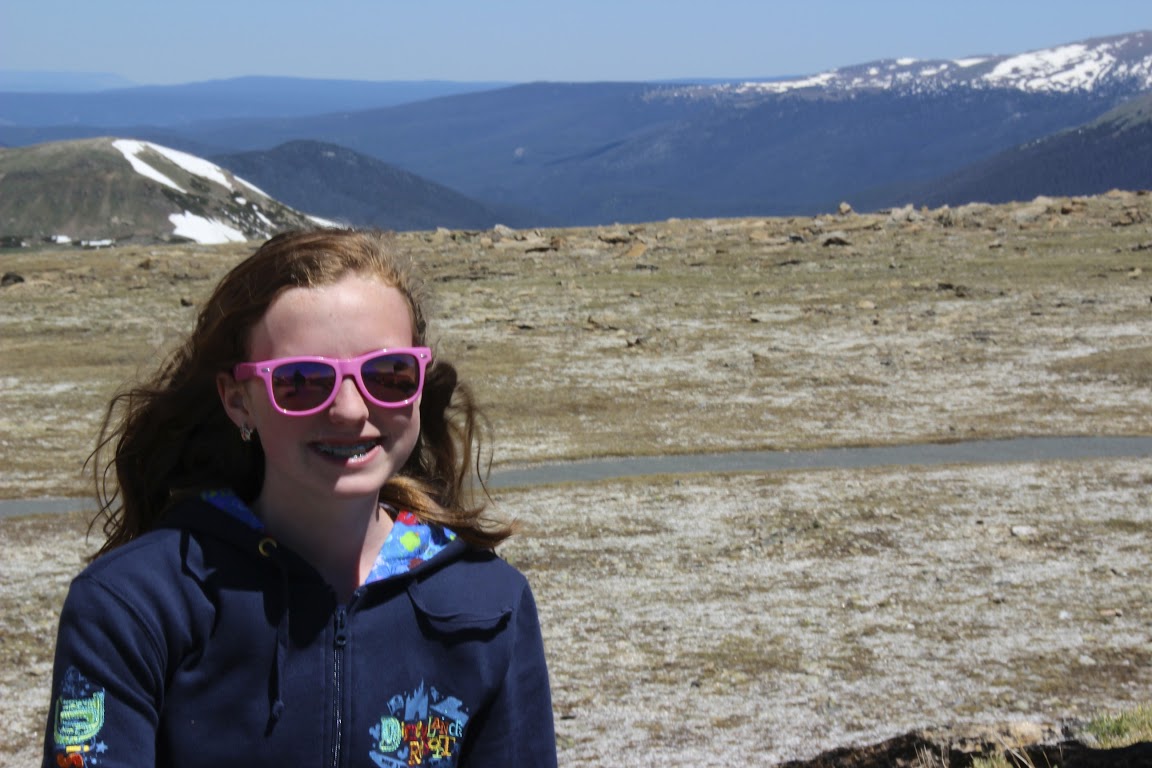
Future Facebook profile photo:
Yikes! Let’s try that one again.
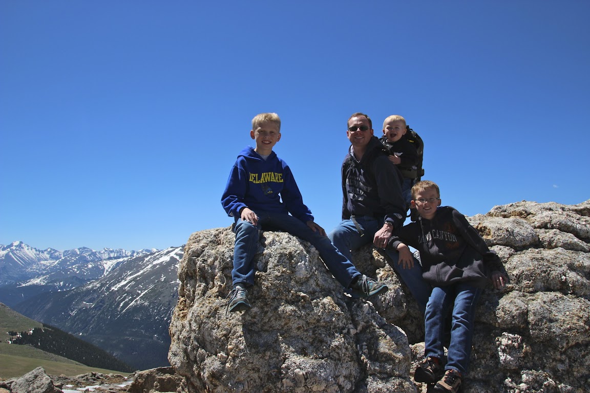
Me and my boyz:
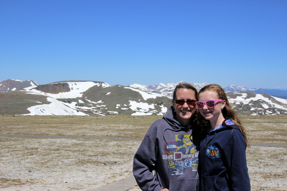
My girlz:
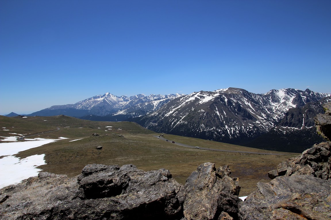
I have to admit, I ran out of ways to describe how glorious the views were up here.
Our lunch stop was the Alpine Visitor Center, which holds the honor of being the National Park building located at the highest elevation of any (approx. 10,500 ft.). It’s only open when Trail Ridge Road is fully open, which is typically from late May to mid-October, depending on how quickly they can clear the snow. So if you’re ever planning a trip here, you only get a limited window to drive the length of Trail Ridge Road. And you won't be able to do that if you're depending on the government's free annual pass program. But I'm not bitter about that.
There’s another hiking trail here, but it basically climbs straight up a mountain slope for a half mile before reaching a viewpoint. We’d had enough of mountain climbing for the day, so we settled for PB&J sandwiches and a tour around the gift shop. And Holy Cheetos, of course.
Throughout our trips, the kids have started various collections (besides junior ranger badges). Sarah collects vintage/retro postcards, David collects patches, and Scotty collects pins. Normally here I'd start to mention the hits my wallet was beginning to take, but they'd earned enough lawn-mowing, snow-shoveling, and babysitting money to be able to start paying for this stuff themselves.
In other words, the hits to my wallet had happened much earlier in the year.
Coming Up Next: More mountains, more wildlife, and Drew takes a shot at cooking up some dinner.
 PB&J seems to taste a lot better when the ambiance is so nice!
  That pizza looks pretty good in the pictures.......... sorry it didn't quite do the trick for you. So cool that you got to do a DISmeet though, and top off the meal with the chocolate chip cookies a la mode! Hard to beat THAT!
 Making a mental note for future reference......just in case!

")
")


 Wow…
Wow…

 Seriously? Just when you think our federal government actually went and did something good and worthwhile...